Os cookies.
Este site utiliza cookies para lhe proporcionar uma melhor experiência de utilização.
OK, ACEITO
Mapas Nabais Conde
Sobre
Itens da coleção
Refinar a pesquisa
Tipo
Cartografia
Autor
Walker, J. & C.
24
Vidal, Alexander Thomas Emeric
14
Owen, William Fitzwilliam
10
Bedford, George Augustus
8
Edgell, J. A.
8
Ver mais
Data
1939-1952
9
1830-1840
10
1810-1824
10
1756-1764
10
1710-1755
9
Ver mais
Local de publicação
Londres
131
Washington
8
Edimburgo
3
Nova Iorque
2
Chicago
1
Ver mais
Assunto
Mapa
79
Portugal
41
Costa Ocidental
30
Oceano Atlântico
30
Mar Mediterrâneo
28
Ver mais
Idioma
Inglês
PT
EN
PT
EN
Biblioteca Geral Digital
Mapas Nabais Conde
Sobre
Itens da coleção
Nesta coleção
Pesquisa avançada
Refinar a pesquisa
Limpar
Tipo
Cartografia
Autor
Walker, J. & C.
24
Vidal, Alexander Thomas Emeric
14
Owen, William Fitzwilliam
10
Bedford, George Augustus
8
Edgell, J. A.
8
Ver mais
Data
1939-1952
9
1830-1840
10
1810-1824
10
1756-1764
10
1710-1755
9
Ver mais
Local de publicação
Londres
131
Washington
8
Edimburgo
3
Nova Iorque
2
Chicago
1
Ver mais
Assunto
Mapa
79
Portugal
41
Costa Ocidental
30
Oceano Atlântico
30
Mar Mediterrâneo
28
Ver mais
Idioma
Inglês
Itens
159
Ver como
Grelha
Lista
Galeria
Ordenar por
Título
Título (descendente)
Data (de publicação)
Data (descendente)
Páginas
1
2
3
4
Limite por página
50
100
250
Cartografia
Map of Portugal
Arrowsmith, Aaron
Cartografia
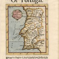
A map of Portugal
Cartografia
Map of South America : For the Ver. Dr. Robertson's History of America
Cartografia
A map of the Kingdom of Portugal
Cartografia
A Map of the River Tale to Lisbon Done from a New Survey
Cartografia
Map of the wine district of the Alto-Douro
Forrester, Joseph James
Cartografia
Mediterranean : Africa : C. Tres Forcas to C. Ivi : surveyed by Captain E. Mouchez of the french Navy 1870-73
Wharton, W. J. L.
Cartografia
Mediterranean : Algeria : Algiers to C. Bougaroni : surveyed by Captain E. Mouchez of the french Navy 1867-9 : with corrections from the french gouvernment charts 1925-1926
Wharton, W. J. L.
Cartografia
Mediterranean : Algeria : Ports d'Oran and Mers-el-Kébir : from the french government chart of 1876 : with corrections to 1953
Edgell, J. A.
Cartografia
Mediterranean : Algeria : Tunis : C. Bougaroni to Fratelli Rocks including Galita Channel
Richards, G. H.
Cartografia
Mediterranean : Algeric : approaches to Bone : from french government chart 1889 : with corrections from the french government chart 1929
Wharton, W. J. L.
Cartografia
Mediterranean : Algérie : C. Ivi to Alger : from the french government charts of 1867-1870 : with additions and corrections to 1951
Wharton, W. J. L.
Cartografia
Mediterranean : Coast of Palestine : Tyre to El Arish
Edgell, J. A.
Cartografia
Mediterranean : Gibraltar : surveyed by Capt. R. M. Southern R. N. and officers of H. M. Surveying ship "Challenger" : 1947-1948
Day, A.
Cartografia
Mediterranean : Israel : Bay of Acre ; Acre Anchorage ; Haifa Harbour
Douglas, H. P.; Edgell, J. A.
Cartografia
Mediterranean : Libya : Porto di Tripoli
Wyatt, Guy
Cartografia
Mediterranean : Tunis : Fratelli Rocks to Mahedia
Richards, G. H.; Boyle, A. J.
Cartografia
Mediterranean : Tunisia : Baie de Tunis : from the french Gouvernment charts of 1893 : with corrections to 1953
Day, A.
Cartografia
Mediterranean : Tunisia : North Coast : Lac de Bizerte and Entrance : from french government charts to 1948 : with corrections to 1957
Edgell, J. A.
Cartografia
Mediterranean Sea : Algérie : C. Ferrat to C. Bougaroni : from the french government surveys of 1868-74 : the coast of Spain from spanish authorities
Richards, G. H.
Cartografia
Mediterranean Sea : Algeria : approaches to Alger : from the french government charts to 1932 : with corrections to 1950
Edgell, John
Cartografia
Mediterranean Sea : Algeria : Port d'Alger : from the french government chart of 1911 : with corrections to 1938
Purey-Cust, H. E.
Cartografia
Mediterranean Sea : Egypt : Alexandria Harbour
Hardy, N. A. C.; Day, A.; Edgell, J. A.
Cartografia
Mediterranean Sea : Egypt : Alexandria to Port Saïd
Reyne, F. A.; Hill, S. A. G.; Douglas, H. P.
Cartografia
Mediterranean Sea : Egypt : approaches to Port Said ; Port Said
Day, Archibald
Cartografia
Mediterranean Sea : Egypt : Damietta to El Arish
Douglas, H. P.
Cartografia
Mediterranean Sea : Europe Gibraltar to Alicante : Africa Cape Spartel to Cape Ferrat : from spanish and french government charts to 1877
Evans, F. J.
Cartografia
Mediterranean Sea : Libya : Ras Ashdir to Sirte : from the italian Gouvernment charts of 1931-32
Edgell, J. A.
Cartografia
Mediterranean Sea : Marocco : Bahia de Ceuta : from the Spanish Gouvernment Chart of 1926 : with corrections to 1956
Douglas, H. P.
Cartografia
Mediterranean Sea : plans of the Coast of Libya : Rada and Porto di Tripoli : from the italian Gouvernment chart of 1930
Parry, J. F.
Cartografia
Mediterranean Sea : Tunisia : East Coast : approaches to Sfax : from the french Gouvernment charts to 1952 : with corrections to 1953
Collins, K. St. B.
Cartografia
Mediterranean Sea : Tunisia : East Coast : Kélibia to Tripoli : principally from french and italian Gouvernment charts to 1954
Collins, K. St. B.
Cartografia
A Military sketch of the country between Lisbon and Vimiero occupied by the British Army under the command of Lieutenant General Viscount Wellington
Cartografia
Mozambique (Portugal)
Cartografia
Mozambique : background notes
United States. Department of State. Bureau of African Affairs
Cartografia
A new and accurate map of Portugal : composed from the latest improvem.ts and adjusted by the most authentic astron. observats.
Cartografia
A new and accurate map of Spain and Portugal : drawn from the best Authorities
Bowen, Thomas
Cartografia
A new and correct chart of the coast of Portugal from Cape Stan to Cape Montego ; A new and correct chart of the coast of Portugal from Cape Montego to Pont de Faro
Cartografia
A new map of Iberia Europaea alias Celtiberia, or Ancient Spain : shewing its principal divisions, cheif cities, townes, rivers, mountains & c[?]. Dedicated to His Highness William Duke of Gloucester
Wells, Edward
Cartografia
A new map of Portugal
Cartografia
A new map of present Spain & Portugal : shewing their principal divisions, cheif cities, townes, rivers, mountains & c. : Dedicated to His Highness William Duke of Gloucester
Wells, Edward
Cartografia
A new map of Spain & Portugal from the latest observatio[ns].
Cartografia
A new map of Spain and Portugal : exhibiting the chains of mountains with their passes, the principal & cross roads, with other details requisite for the intelligence of Military Operations
Nantiat, Jasper
Cartografia
A new map of Spain and Portugal : exhibiting the chains of mountains with their passes, the principal & cross roads, with other details requisite for the intelligence of Military Operations
Nantiat, Jasper
Cartografia
A new map of the Kingdom of Portugal divided into its provinces
Cartografia
A new map of the kingdoms of Spain and Portugal with their principals divisions.
Cartografia
A new military map of Portugal : the roads from the Carta Militar published by the french in Lisbon : the rivers and mountains from the last Authorities
Elliott, Wm, Capt.
Cartografia
A new military map of Portugal : the roads from the Carta militar published by the french in Lisbon, the rivers and montains, from the best authorities
Elliott, Wm, Capt.
Cartografia
A plan of the city of Lisbon with the Harbour, Forts, Depth of Water and Country adjacent : for the Lond. Mag.
Cartografia
Plan of the town and environs of Porto