Os cookies.
Este site utiliza cookies para lhe proporcionar uma melhor experiência de utilização.
OK, ACEITO
Sobre
Itens da coleção
Refinar a pesquisa
Coleções digitais
Biblioteca Geral
22
Mapas Nabais Conde
22
500 Anos da Biblioteca
1
Tipo
Cartografia
22
Livro Moderno
1
Autor
Edgell, J. A.
3
Estados Unidos da América. Central Intelligence Agency
3
Estados Unidos da América. Department of State
3
Collins, K. St. B.
2
Day, A.
2
Ver mais
Data
1955-1974
Local de publicação
Londres
13
Washington
8
Langley
1
New York
1
Assunto
Mapa
9
Mar Mediterrâneo
8
Espanha
4
Oceano Atlântico
4
Portugal
4
Ver mais
Idioma
Inglês
PT
EN
PT
EN
Biblioteca de Fundo Antigo da UC
Almamater
Em destaque
Todos os itens
Sobre
Nesta coleção
Pesquisa avançada
Refinar a pesquisa
Limpar
Coleções digitais
Biblioteca Geral
22
Mapas Nabais Conde
22
500 Anos da Biblioteca
1
Tipo
Cartografia
22
Livro Moderno
1
Autor
Edgell, J. A.
3
Estados Unidos da América. Central Intelligence Agency
3
Estados Unidos da América. Department of State
3
Collins, K. St. B.
2
Day, A.
2
Ver mais
Data
1955-1974
Local de publicação
Londres
13
Washington
8
Langley
1
New York
1
Assunto
Mapa
9
Mar Mediterrâneo
8
Espanha
4
Oceano Atlântico
4
Portugal
4
Ver mais
Idioma
Inglês
Itens
23
Ver como
Galeria
Lista
Grelha
Ordenar por
Título
Título (descendente)
Data (de publicação)
Data (descendente)
Limite por página
50
100
250
Cartografia
Angola : background notes
Cartografia
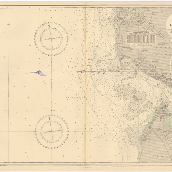
France : West Coast : Entrance to La Gironde : from the french government charts of 1887 : with additions and corrections to 1955
Cartografia
Iceland
Cartografia
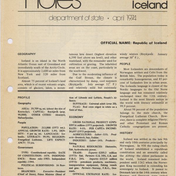
Iceland : background notes
Cartografia
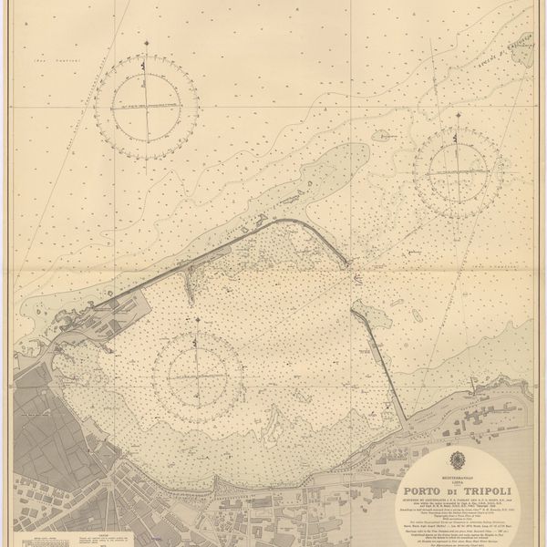
Mediterranean : Libya : Porto di Tripoli
Cartografia
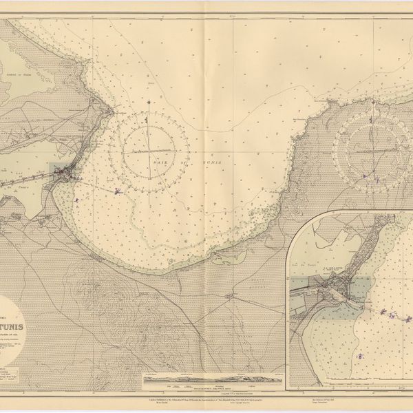
Mediterranean : Tunisia : Baie de Tunis : from the french Gouvernment charts of 1893 : with corrections to 1953
Cartografia
Mediterranean : Tunisia : North Coast : Lac de Bizerte and Entrance : from french government charts to 1948 : with corrections to 1957
Cartografia
Mediterranean Sea : Egypt : Alexandria Harbour
Cartografia
Mediterranean Sea : Marocco : Bahia de Ceuta : from the Spanish Gouvernment Chart of 1926 : with corrections to 1956
Cartografia
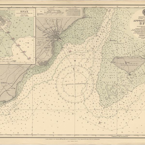
Mediterranean Sea : Tunisia : East Coast : approaches to Sfax : from the french Gouvernment charts to 1952 : with corrections to 1953
Cartografia
Mediterranean Sea : Tunisia : East Coast : Kélibia to Tripoli : principally from french and italian Gouvernment charts to 1954
Cartografia
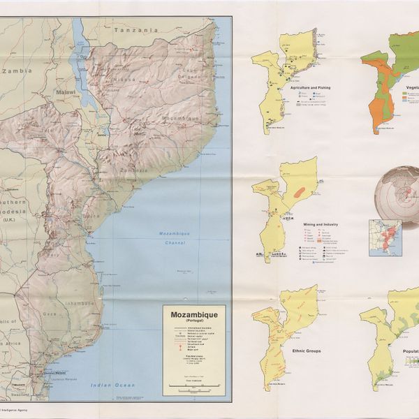
Mozambique (Portugal)
Cartografia
Mozambique : background notes
Cartografia
Portsmouth to Canary Islands (Islas Canarias) and the Azores (Açôres) : compiled from the latest information in the hydrographic Department, 1954
Cartografia
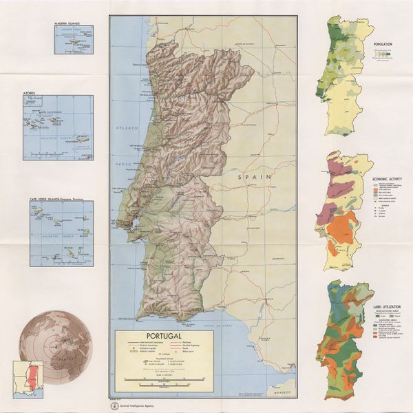
Portugal
Cartografia
Portugal : background notes
Cartografia
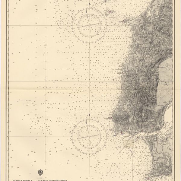
Portugal : Berlenga to Cabo Espichel including the approaches to Rio Tejo : compiled from portuguese government charts to 1935 : with additions and corrections to 1956
Livro Moderno
The Portuguese in South Africa; with a description of the native races between the river Zambesi and the Cape of Good Hope during the sixteenth century
Cartografia
Spain
Cartografia
Spain : background notes
Cartografia
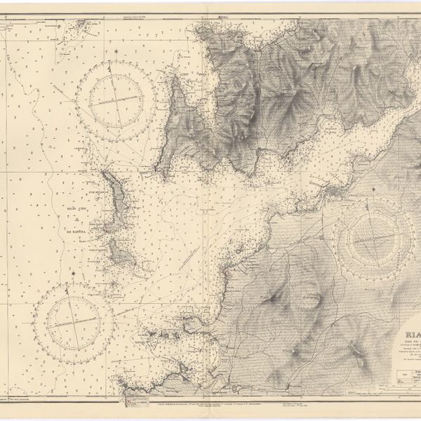
Spain : West Coast : Ria de Vigo : from the spanish government chart of 1912
Cartografia
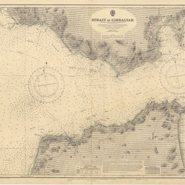
Strait of Gibraltar : from the spanish government charts of 1936 : with corrections to 1953
Cartografia
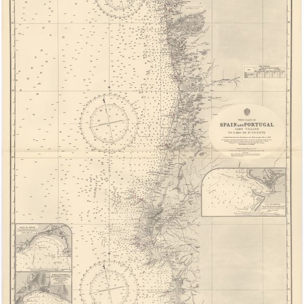
West coast of Spain and Portugal : Cabo Villano to Cabo de S.º Vicente : compiled from the latest information in the Hidrographic Office to 1958